Introduction to Geophysical Exploration in Physics
Geophysical exploration is a branch of physics that focuses on using various measurement techniques to investigate the physical properties and structures of the subsurface of the Earth. This field of study is crucial for understanding the composition, structure, and processes of the Earth’s interior and for locating and characterizing valuable resources such as minerals, oil, and gas.
Geophysical exploration methods rely on different physical principles, such as gravity, magnetism, electricity, and seismic waves, to gather information about the subsurface. By measuring and analyzing these physical properties, geophysicists can create a detailed image of the Earth’s subsurface and gain insights into its geological features.
Gravity surveys involve measuring the variations in the gravitational field of the Earth. These surveys can help identify areas of differing rock densities, which can indicate the presence of underground structures like faults, folds, or mineral deposits.
Magnetic surveys utilize magnetometers to measure the variations in the Earth’s magnetic field. This method is useful for identifying magnetic anomalies caused by rocks with different magnetic properties, often indicating the presence of minerals or geological structures.
Electrical and electromagnetic methods measure the electrical conductivity or resistivity of rocks, which can give insights into their composition and structure. This technique is commonly used in mineral exploration and groundwater studies.
Seismic exploration is one of the most widely used methods in geophysics. It involves generating and analyzing seismic waves that propagate through the Earth. By sending sound waves into the ground and measuring the reflections and refractions of these waves, geophysicists can map subsurface structures, identify rock layers, and locate potential oil and gas reservoirs.
Overall, geophysical exploration plays a critical role in understanding the subsurface of the Earth and identifying valuable resources. By combining different methods and interpreting the data collected, geophysicists can provide valuable insights for industries such as oil and gas, mining, and geotechnical engineering.
Principles and Methods of Geophysical Exploration
Principles and Methods of Geophysical Exploration refers to the scientific techniques and strategies used in the field of geophysics to investigate the subsurface of the Earth. Geophysical exploration involves the measurement, analysis, and interpretation of physical properties and phenomena to gain valuable knowledge about the subsurface structures, geological formations, and natural resources.
Here are some principles and methods commonly used in geophysical exploration:
1. Gravity Method: Gravity surveys measure variations in the Earth’s gravitational field caused by differences in rock density. This method helps identify subsurface features like faults, salt domes, and mineral deposits.
2. Magnetic Method: Magnetic surveys measure variations in the Earth’s magnetic field caused by different magnetic properties of rocks. This method is effective in mapping subsurface structures and mineral deposits.
3. Electrical Resistivity Method: Electrical resistivity surveys measure the ability of rocks to conduct electrical currents. This method is used for mapping subsurface geology, groundwater resources, and detecting ore bodies.
4. Seismic Reflection Method: Seismic surveys generate and record artificially induced seismic waves to image the subsurface. This method helps in identifying various rock layers, faults, and potential hydrocarbon reservoirs.
5. Seismic Refraction Method: Seismic refraction surveys involve measuring the travel time and velocity of seismic waves refracting through subsurface layers. This method is used to determine the depth and structure of subsurface geology, especially for engineering applications.
6. Ground-Penetrating Radar (GPR): GPR uses electromagnetic waves to image subsurface features. It is widely used for mapping shallow structures, detecting underground utilities, and assessing pavement thickness.
7. Electromagnetic (EM) Method: Electromagnetic surveys measure the response of subsurface materials to induced electromagnetic fields. This method is useful for mapping conductive bodies, such as mineral deposits.
8. Remote Sensing: Remote sensing techniques, including satellite imagery and aerial photography, provide valuable data for mapping surface features, identifying geological structures, and monitoring environmental changes.
9. Well Logging: Well logging involves the measurement of physical properties (e.g., electrical, acoustic, radioactive) of rocks in boreholes. It aids in characterizing subsurface formations, determining hydrocarbon potential, and assessing well performance.
It is important to note that the choice of geophysical methods depends on various factors, including the target substance or feature, depth of investigation, desired resolution, and environmental conditions. Multiple methods are often used in combination to achieve more accurate and comprehensive results in geophysical exploration.
Applications of Geophysical Exploration in Various Fields
Geophysical exploration involves the use of various measurement techniques to study the physical properties of the Earth’s subsurface. It has a wide range of applications in different fields, including:
1. Oil and gas exploration: Geophysical exploration is extensively used in the oil and gas industry to locate potential reservoirs. Techniques such as seismic surveys, gravity surveys, and magnetometer surveys are used to identify subsurface formations that may contain hydrocarbon deposits.
2. Mineral exploration: Geophysical methods are also employed in the mining industry to map and identify mineral deposits. Techniques like electromagnetic and magnetic surveys can help locate ore bodies and determine their size and depth.
3. Environmental studies: Geophysical exploration is utilized in environmental studies to assess soil and groundwater contamination, detect buried hazardous waste, and evaluate the stability of dams and landfills. Geophysical techniques can provide valuable information about subsurface conditions without the need for invasive drilling or excavation.
4. Engineering and construction: Geophysical surveys are commonly employed in engineering and construction projects to assess soil and rock properties, locate underground utilities, and determine the suitability of a site for various projects. Methods such as resistivity surveys, seismic refraction, and ground-penetrating radar can provide insights into the subsurface geology and aid in designing safe and cost-effective structures.
5. Geothermal energy exploration: Geophysical techniques play a crucial role in exploring and developing geothermal energy resources. By mapping subsurface temperatures, rock properties, and fluid reservoirs, geophysical surveys can identify areas with high geothermal potential and guide the development of geothermal power plants.
6. Archaeology: Geophysical methods, such as ground-penetrating radar and electromagnetic surveys, are used in archaeological studies to detect and map buried structures, artifacts, and ancient settlements. These techniques can help archaeologists identify potential excavation sites and preserve delicate historical remains.
7. Climate and environmental research: Geophysical exploration is essential in studying climate change, understanding geological processes, and monitoring natural hazards. Remote sensing techniques, including satellite-based sensors and airborne surveys, provide valuable data for monitoring changes in sea-level rise, land use, and natural disasters such as earthquakes and volcanic eruptions.
These are just a few examples of the many applications of geophysical exploration in various fields. The versatility of geophysical techniques makes them valuable tools for understanding and managing the Earth’s subsurface, contributing to advancements in various industries and scientific research.
Limitations and Challenges of Geophysical Exploration
Geophysical exploration is a method used to study the physical properties of the Earth’s subsurface by collecting and analyzing data from various geophysical techniques. While this approach has proven to be valuable in many geological and environmental investigations, there are several limitations and challenges associated with geophysical exploration. Some of these include:
1. Depth limitations: Geophysical methods have a limited depth range of penetration. Different techniques have different depths of investigation, ranging from a few meters to several kilometers. This means that deeper geological features may not be adequately resolved or accurately characterized using geophysical exploration alone.
2. Resolution limits: Geophysical methods generally have lower resolution compared to other techniques such as drilling or direct sampling. The resolution is determined by the wavelength of the physical property being measured, and larger wavelengths result in lower resolution. This can make it difficult to accurately define small-scale features or subtle variations in the subsurface.
3. Complex geology: In areas with complex geological structures or heterogeneous subsurface conditions, geophysical data can be challenging to interpret. Different rock types, faulting, folding, and other geological complexities can create uncertainty in the interpretation of geophysical data, leading to potential misinterpretations.
4. Data interpretation: Geophysical data interpretation requires expertise and experience in order to accurately interpret and model subsurface geological structures. It can be difficult to distinguish between different subsurface features and differentiate between artifacts and true geological anomalies. This highlights the importance of integrating multiple geophysical techniques and geological information to obtain a more comprehensive understanding of the subsurface.
5. Cost and logistics: Geophysical exploration can be costly, especially when employing more advanced techniques or covering large areas. The equipment required for geophysical surveys can be expensive, and data collection may require specialized training and personnel. Additionally, logistical challenges such as access to remote or challenging terrains can add to the overall cost and complexity of geophysical exploration.
6. Environmental considerations: Some geophysical techniques, such as seismic surveys, can have potential environmental impacts. For example, the use of explosives for seismic surveys can create noise pollution and disturb wildlife. There is also a need for careful planning and implementation to minimize disturbance to sensitive ecosystems and habitats.
7. Limitations of specific techniques: Each geophysical technique has its own limitations and constraints. For example, electromagnetic surveys may be affected by terrain conductivity variations, and gravity surveys may be influenced by local mass variations. Understanding these limitations and constraints is critical in selecting the appropriate techniques for a particular study area.
In summary, while geophysical exploration provides valuable insights into the subsurface, it is important to recognize and address the limitations and challenges associated with the various techniques. Careful planning, integration of multiple methods, and expertise in data interpretation are necessary to obtain accurate and reliable information about the Earth’s subsurface.
Future Developments and Potential of Geophysical Exploration
Geophysical exploration is a branch of geophysics that involves the use of various remote sensing and imaging techniques to study the Earth’s subsurface and understand its geological structures, resources, and processes. This field has been instrumental in the discovery and development of natural resources such as minerals, oil, and gas.
In recent years, there have been significant advancements in geophysical exploration techniques, driven by advancements in technology and data analysis. One major development is the use of integrated geophysical methods, which combine different techniques to provide a more comprehensive understanding of subsurface structures. For example, combining seismic reflection, gravity, and magnetic data can help identify potential reservoirs and traps for hydrocarbons.
Another area of potential development is in non-destructive and non-invasive techniques for environmental and engineering applications. Geophysical exploration methods can be used to assess soil and groundwater quality, detect underground contaminants, or monitor the stability of infrastructure such as dams and bridges. With ongoing research and development, these techniques could become more accurate, efficient, and cost-effective.
Furthermore, advancements in data processing and interpretation techniques are playing a crucial role in unlocking the potential of geophysical exploration. With the help of sophisticated algorithms and machine learning, geophysicists can extract valuable information from large datasets and make more accurate interpretations of subsurface features. This can lead to better-targeted drilling and exploration efforts, thereby optimizing resource exploration and extraction.
The potential of geophysical exploration extends beyond Earth as well. Techniques used in geophysics have proven beneficial in exploring other planets and celestial bodies. For example, seismic data collected from Mars missions have provided valuable insights into the planet’s internal structure and geologic history. Geophysical exploration methods could play a vital role in future space missions and contribute to our understanding of the universe.
In conclusion, geophysical exploration has a promising future with potential developments in integrated methods, non-destructive techniques, data processing, and space exploration. With ongoing advancements, this field will continue to play a vital role in resource exploration, environmental assessments, and our understanding of the Earth and beyond.
Topics related to Geophysical exploration
Lecture 9 : Geophysical Exploration – YouTube

Lecture 9 : Geophysical Exploration – YouTube
Lec 28 – Geophysical Investigation Part 1 – YouTube

Lec 28 – Geophysical Investigation Part 1 – YouTube
Seismics Part1 | Basics | Exploration Geophysics – YouTube

Seismics Part1 | Basics | Exploration Geophysics – YouTube
What is Geophysics? – YouTube

What is Geophysics? – YouTube
Basic principles of the seismic method | Seismic Principles – YouTube

Basic principles of the seismic method | Seismic Principles – YouTube
3D Seismic – YouTube
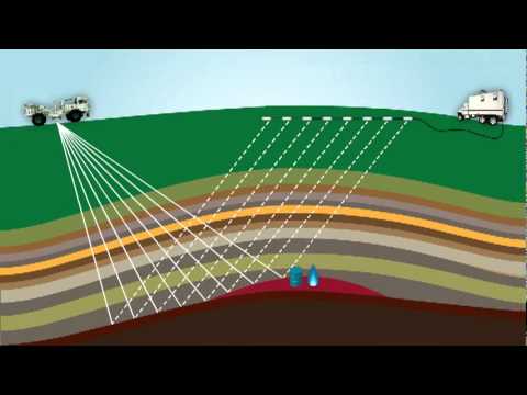
3D Seismic – YouTube
Hydrogeology 101: GeoVES – Free 1D VES inversion for groundwater exploration – YouTube
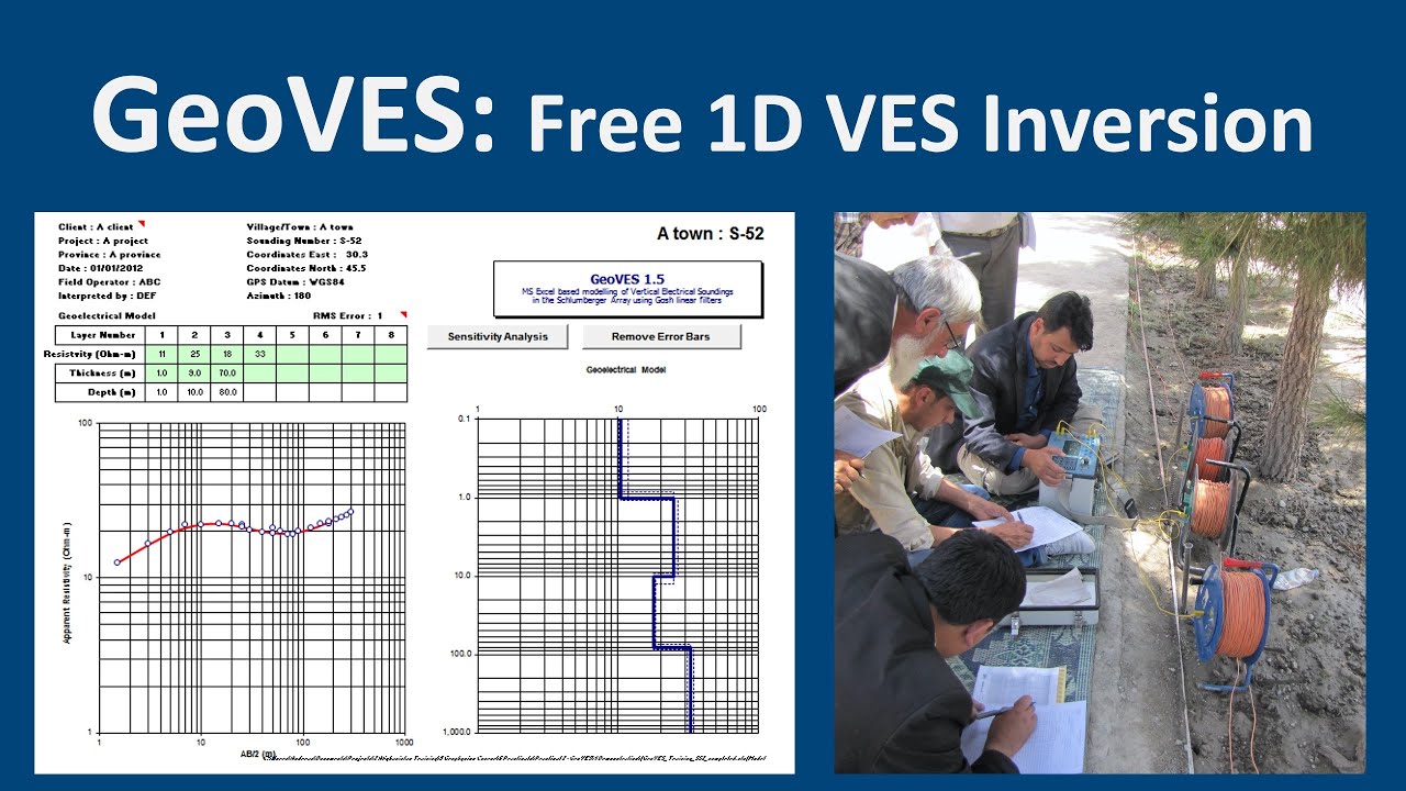
Hydrogeology 101: GeoVES – Free 1D VES inversion for groundwater exploration – YouTube
The Soil Matters – Energy, Water, & Vibrations | Stefan Burns Live #9 – YouTube

The Soil Matters – Energy, Water, & Vibrations | Stefan Burns Live #9 – YouTube
Offshore Seismic Surveying – YouTube

Offshore Seismic Surveying – YouTube
Geophyscial Methods of Groundwater Exploration. – YouTube
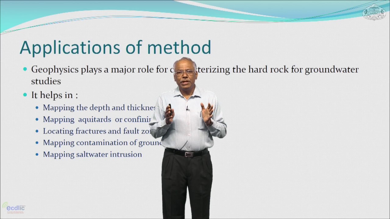
Geophyscial Methods of Groundwater Exploration. – YouTube

Konstantin Sergeevich Novoselov is a Russian-British physicist born on August 23, 1974. Novoselov is best known for his groundbreaking work in the field of condensed matter physics and, in particular, for his co-discovery of graphene. Novoselov awarded the Nobel Prize in Physics. Konstantin Novoselov has continued his research in physics and materials science, contributing to the exploration of graphene’s properties and potential applications.